

- By late May, at least 48 people were killed in rural areas of Colombia following clashes between the FARC guerrilla dissident groups controlled by the aliases “Calarcá” and “Iván Mordisco.”
- Conflicts have displaced 10 Indigenous Jiw families from the municipality of Mapiripán, Meta department. They had to reach the urban area of San José del Guaviare for protection.
- The clashes occurred near the Tomachipán-Cumare road, an illegal trail used by dissident armed cells as a strategic corridor to mobilize and transport drug trafficking supplies in the Guaviare department.
- Experts warn that controlling this disputed area is important for armed groups, as it means dominating strategic zones in the department and also being closer to the Venezuelan border.
Since the end of May, rural areas of San José del Guaviare, the capital city of the Guaviare department in the Colombian Amazon, have once again been turned into a war zone.
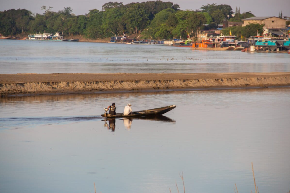
A series of clashes between dissident cells of the Revolutionary Armed Forces of Colombia (FARC), demobilized in 2016, and commanded by Alexander Díaz Mendoza, alias “Calarcá,” and Néstor Gregorio Vera Fernández, alias “‘Iván Mordisco,” has resulted in the deaths of at least 48 people. The warfare between the two armed groups concentrates on a strategic area for illicit economies on the Guaviare River, a tributary of the Orinoco River.
The rural community of Cumare, as well as the Nukak and Jiw Indigenous people of the Barranco Colorado Reserve (an ancestral territory in San José del Guaviare), started hearing gunshots and rushed to hide. Since that frightening day, May 26, they have avoided leaving their homes. “People are on maximum alert; no one moves because they fear being caught in the middle of the confrontation,” said a resident of Charras, another rural area of San José del Guaviare, who requested anonymity for safety reasons.
“We knew something like this could happen. A bomb fell in the middle of a sports field here in the Siberia rural district,” said a woman who has witnessed the clashes since their very beginning; she also requested anonymity.
Colombian Defense Minister Pedro Sánchez stated, “The criminal structures of alias ‘Mordisco’ and ‘Calarcá’ fought in the Barranco Colorado sector, jurisdiction of San José del Guaviare, more than 140 kilometers [86.9 miles] east of the urban area, over disputes involving drug trafficking, extortion and other illicit economies.” According to the authority, the 48 victims were reportedly members of the Mordisco-led faction. Sánchez also noted that, among them, were minors recruited in the southwestern Cauca department.
A January 2026 investigation published (in Spanish) by Mongabay and Colombian independent news outlet Rutas del Conflicto revealed the consolidation of the Tomachipán-Cumare road. This illegal corridor traverses the Nukak Indigenous Reserve in a straight line, from south to north, until it reaches the Barranco Colorado Reserve. The January story documented how both dissident armed groups have fought over this territory’s control and have opened this trail between the Inírida and Guaviare rivers to carry cocaine, weapons and explosive material in the middle of the Amazon forest. Conflicts between the cells controlled by Calarcá and Mordisco erupted very close to this road, which is considered a vital area for the functioning of both groups’ growing illicit businesses.
The cultivation of coca crops also prevails around this 47.5-kilometer (30-mile) trail. Satellite analysis conducted by Mongabay showed that since 2019, there are at least 30 hectares (74 acres) of crops 5 km (3.1 mi away from the trail, and 430 hectares (1,062 acres) 15 km (9.3 mi away from it. Just 5 km from the road, crops have increased 58% between 2019 and 2025.
A never-ending dispute
A former combatant of FARC’s Eastern Bloc told Mongabay that this trail provides a shorter alternative for groups transporting the cocaine paste found in the Nukak National Natural Reserve. “It is much easier to move in a straight line from [the small community of] Tomachipán to the Guaviare River than to go through the Inírida River and go up to San José del Guaviare,” he said.
For the dissident blocs of Calarcá and Mordisco, it is vital to control this sector. Whoever does it will possess the north of the Guaviare department, the south of the Meta (Central) department and the Guaviare River, which leads to the east of the (eastern) Guainía department, which borders Venezuela. The disputes between these two dissident groups, as explained by a source related to the matter who requested anonymity, take place at a strategic point that works as a “hinge” among river corridors, clandestine trails and dense jungle areas that are challenging to access.
From that location, it is possible to connect routes to the Guaviare and Inírida rivers, move shipments of cocaine and weapons, control the transit between districts, extort individuals and also take control of legal economies — such as cattle ranching. It also allows groups to be present in areas near the Nukak Indigenous Reserve, home to coca plantations and drug laboratories. Historically, the area has been marked by the presence of armed groups and was once dominated by the former FARC guerrillas.

Kyle Johnson, a lead researcher at the Bogotá-based Conflict Responses Foundation, told Mongabay that the latest massacre in May adds to ‘Calarcá’s’ offensive to conquer former territories held by Mordisco. “It is a territory [one uses] for reaching the border, passing through several towns, and reaching Venezuela. Calarcá does not have dominance over the borders, and that is important for him,” Johnson said.
According to the expert, it constitutes a “key area” for controlling both legal and illicit economies in the department due to its connection with river corridors. Dominating this territory, in Johnson’s opinion, would likewise allow Calarcá to strike Mordisco’s dissidents militarily, mainly by interrupting communications between different armed factions operating in Guaviare and Meta departments.
This interpretation is echoed by a researcher from the Colombian NGO Institute of Studies for Development and Peace, who also asked not to be identified. This source said that Calarcá’s dissidents have “opened roads in the area and promoted a deliberate strategy of territorial conquest and control, especially toward [the department of] Caquetá.” According to the researcher, this land expansion paved the way for settlers and the development of cattle ranching and agro-industrial projects that consolidate dissident groups’ dominance over the territory, even without a permanent armed presence.
The Barranco Colorado sector, in Guaviare, connects to the so-called “Cattle Trail” (Trocha ganadera in Spanish). This illegal corridor, opened in the middle of the Guaviare forest, crosses the biodiverse Sierra de La Macarena National Natural Park to connect farms, move cattle and enable access to increasingly deeper areas of the Amazon Rainforest.
As a result of the constant clashes between armed groups, communities living along the Cattle Trail are now confined. “Having control over the ‘Cattle Trail’ means being closer to San José del Guaviare and controlling the entire department, heading toward Caquetá,” said a field researcher who joined the list of sources preferring not to be identified for fear of retaliation.

Jiw and Nukak Indigenous in imminent danger
Since 2024, the humanitarian crisis in Guaviare has skyrocketed following clashes between the dissidents of aliases Calarcá and Mordisco in strategic corridors of the department. In the midst of the war, Jiw Indigenous communities have been trapped between armed restrictions, the fear of displacement and the risk of confinement. Authorities and humanitarian organizations warned about families that were forced to abandon their territories or limit their daily-life mobility to avoid being caught in the crossfire.
On May 27, following violent events, some 10 families of the Jiw Indigenous people arrived in the urban zone of San José del Guaviare in conditions of displacement after crossing the Guaviare River, coming from the municipality of Mapiripán, Meta department. “They arrived at the sports center. The ‘Calarcá’ group displaced them after finding that some young people from the community went for military service,” said Yuldor Muñoz, the Indigenous representative for the San José del Guaviare’s Mayor’s Office.
By late May, the Jiw Indigenous community of the Barranco Colorado Reserve had not yet reached San José del Guaviare. Indigenous leaders from the city’s urban area were expecting them to arrive shortly, though the timing remained uncertain. “Right now, we can’t know for sure if they will arrive. The guerrilla is still in the area, and there is no way to leave the territory. We have not been able to communicate with the leaders there. We don’t know if it is the Army or the others [groups] who are blocking the signal,” said one of the Jiw Indigenous leaders. He also requested anonymity.
This story of war and blood is not new for the Nukak and the Jiw peoples. In December 2024, a massacre near the Barranco Colorado Reserve left four people killed, including a minor and an official from the Colombian Institute of Family Welfare (ICBF, in Spanish), a state-owned child protection entity. The episode was confusing — and no one knew what was happening. A few answers came to light a month later when Colombia’s People’s Defender Office issued an early warning citing imminent risks in the area due to a territorial and resource dispute between FARC dissident groups.
Since the arrival of displaced Jiw Indigenous individuals in San José del Guaviare on May 27, the city mayor, Willy Rodríguez, requested support from Colombia’s Interior Ministry and the national government to address the ongoing humanitarian crisis. By late May, public forces were located on the Cattle Trail but had yet to reach the site where the recent massacre transpired. “The municipality has tried to respond with aid and support, but our capacity is already overwhelmed,” said Muñoz.
On May 28, the Colombian Army’s Fourth Division informed that it had activated a communal social route that would allow the bodies of the 48 victims to be transferred to a point agreed upon with civil authorities and humanitarian organizations. “The Military Forces [of Colombia] will continue to deploy their capabilities to protect the civilian population,” the institution stated.
A public force official, speaking anonymously, told Mongabay and Rutas del Conflicto that, since the afternoon of May 28, coordinations between San Jose del Guaviare’s Mayor’s Office, Colombia’s People’s Defender Office, the Organization of American States Mission to Support the Peace Process in Colombia, the U.N. and the International Committee of the Red Cross resulted in a humanitarian corridor. It was established to transfer the bodies to Colombia’s official government entity that provides forensic services (Medicina Legal) and address potential new displacements. “The bodies arrived at 6 a.m [on May 29]. We are still waiting to see if the community will be displaced,” he said, indicating that there were reportedly minors among the deadly victims.
The situation in the Guaviare department is a matter of great concern, as the Nukak and Jiw peoples are part of the 34 Indigenous peoples identified by the Constitutional Court in 2009 as being at risk of physical and cultural disappearance, mainly due to the impacts of local armed conflicts. The Colombian high court warned that these communities “have been victims of very serious violations of their individual and collective fundamental rights, and of International Humanitarian Law.”
Banner image: The Tomachipán-Cumare road is an illegal trail used by dissidents as a strategic corridor. It has become an epicenter of violence. Image by Juan Carlos Contreras.
What’s at stake for the environment in Colombia’s upcoming election?
The story was first published here in Spanish on May 30, 2026.
FEEDBACK: Use this form to send a message to the author of this post. If you want to post a public comment, you can do that at the bottom of the page.
Credits

This story first appeared on Mongabay
This article is licensed under a Creative Commons Attribution-NoDerivatives 4.0 International License.
You may republish this article, so long as you credit the authors and Mongabay, and do not change the text. Please include a link back to the original article.